


[POST] The Pentagon will adjust to an increasingly "verticalized" global map
A reasonable plan to RIF the UCP

This is a reader-supported publication. I give it all away for free but could really use your support if you want me to keep doing this.
CSIS (Center for Strategic and International Studies) has a new report out that proposes a sort of Reduction in Force (RIF) for the Unified Command Plan (UCP). It actually calls for, and presents, a “new map” for America.
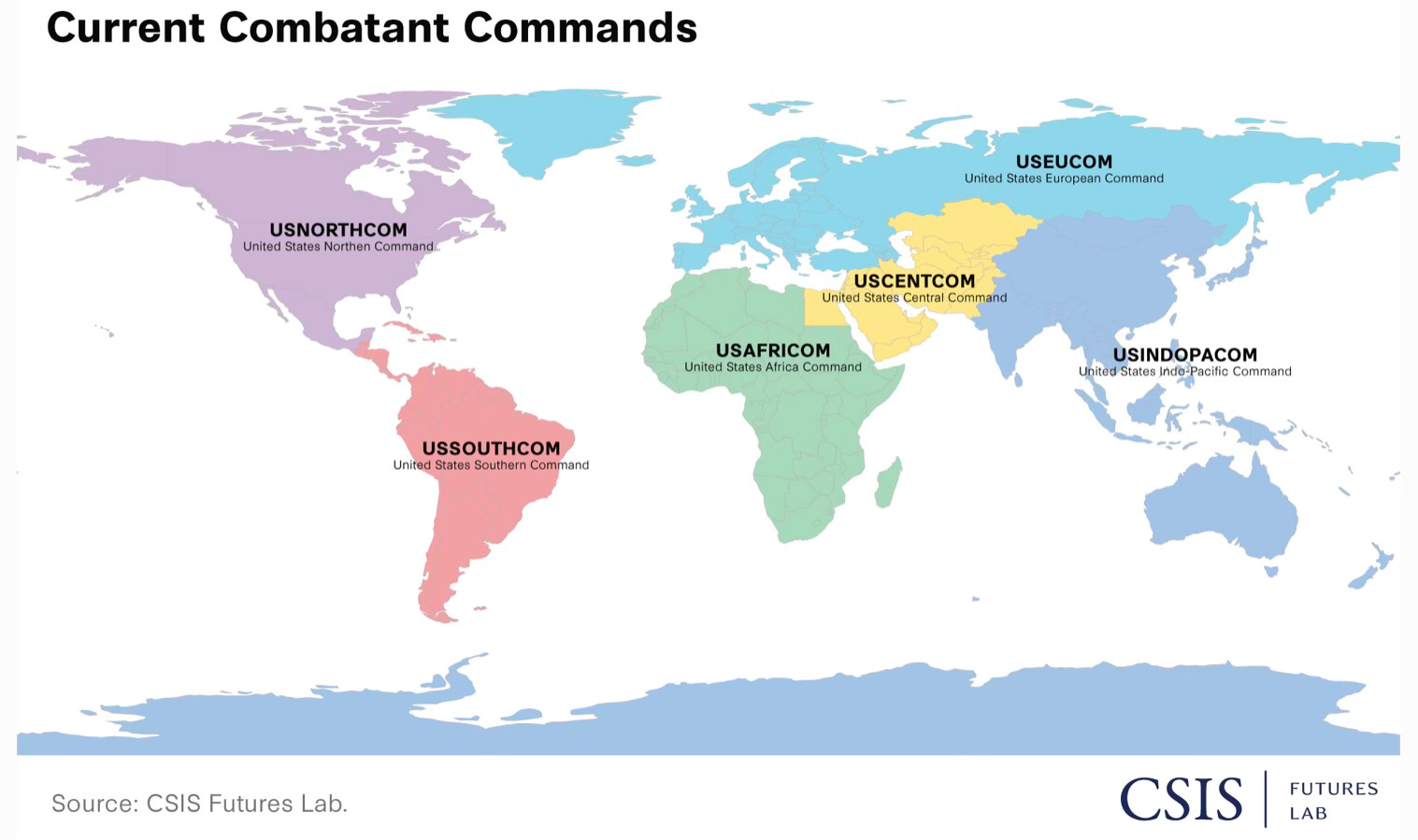
First, to describe the current UCP:
There are seven geographic combat commands:
NORTHCOM (North America)
SOUTHCOM (Latin America)
EUCOM (Europe + Russia)
CENTCOM (Middle East, Central Asia
AFRICOM (all of Africa save Egypt)
INDOPACOM (Indian Ocean and Asia and Pacific)
SPACECOM (Karman Line of 62 miles above surface and beyond)
And four functional/support commands
TRANSCOM (transportation)
SOCOM (special operations)
CYBERCOM (cyber operations)
STRATCOM (nuclear operations).
All eleven are headed by a four-star.
Trump and Hegseth are looking to reduce and consolidate commands — as well as four-star generals and admirals.
The CSIS report proposes a structure that goes from 11 commands to six commands.
What interests me is how this proposal would align with my own evolved thinking regarding the UCP over the years.
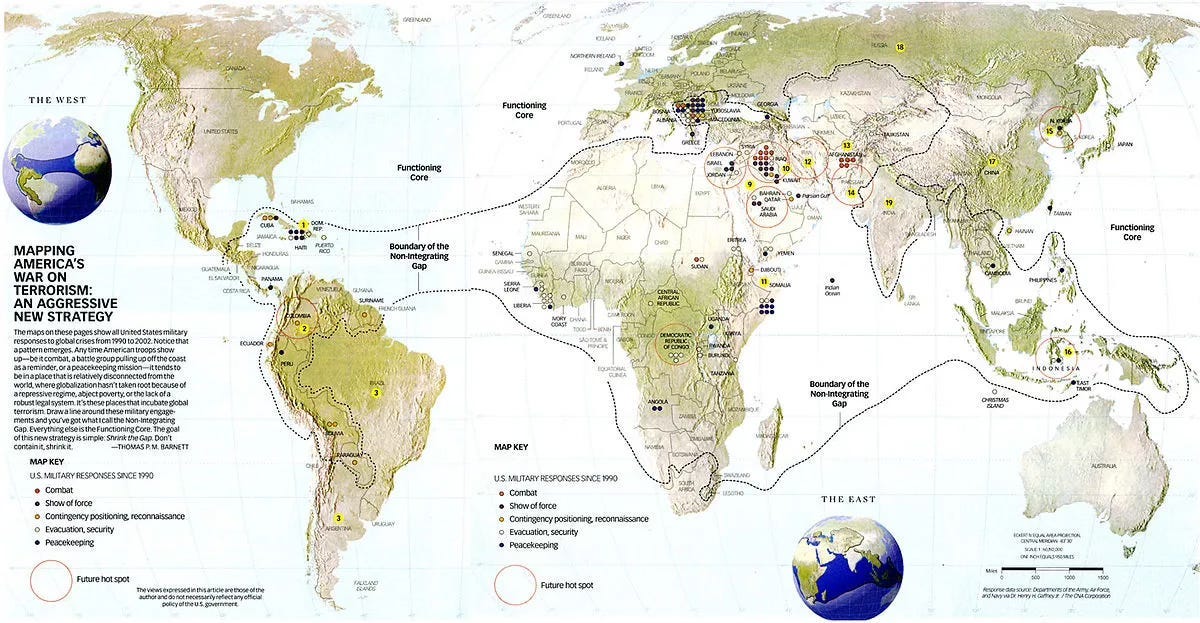
Back in the day, I did predict and support the rise of Africa Command as distinct from European Command. Per my Pentagon’s New Map breakdown of the world, I saw Africa as the center of gravity in a Long War against radical Salafi jihadism. My prediction was simple enough:
The Long War began in Central Command (Persian Gulf area), but, as we succeeded there and the Middle East began more pervasively connecting itself to the outside world (see PG monarchies today), that fight could go one of two directions.
North into Central Asia — unlikely, given the willingness of non-Muslim neighboring powers to combat that.
Southwest into Africa and specifically the Trans Sahel — far more likely because of the weakness of that region’s governments and its overall poor connectivity to the world.
The latter prediction has come true, with the current commander of AFRICOM describing the Trans Sahel as the “epicenter” of global terrorism.
Below you see how I defined the Core-Gap breakdown between globalization’s well-connected/connecting nations and its poorly/more narrowly connected regions. The shape and location of the Gap basically the lower latitudes stretched across the planet.
From America’s New Map:
Two decades ago, I was tasked by my superiors in the Office of the Secretary of Defense to explain how 9/11 had redrawn our military’s geostrategic outlook. My book The Pentagon’s New Map, which began as a PowerPoint briefing delivered throughout the US government and overseas, subsequently morphed into a viral Esquire article and landed on the New York Times bestseller list. Over the years, its iconic image of the world has been replicated in military strategy documents around the world, often without attribution—the map having outgrown its maker.
To populate this new map, I plotted where US military forces had been deployed around the world since the Cold War’s end in response to conflicts, crises, and disasters. I then simply drew a line encompassing virtually all of them, resulting in an equatorially centric shape falling overwhelmingly within a latitudinal band stretching 30 degrees north and south (rechristened here as Middle Earth). Upon further research, it became clear that my map comprised all the mass violence within the global system, concentrated in less-developed nations narrowly or weakly connected to the global economy—hence my mantra, Disconnectedness defines danger.
My map revealed a world that the US military had been tasked with reluctantly managing: those “non-integrated gap” regions that lacked globalization’s stabilizing networks and the rules that come with them, leaving them susceptible to civil strife that fosters terrorism and other transnational instabilities.
What I presented to admirals and generals in briefings merely confirmed what they had long been experiencing, which is why they embraced that perspective in the years that followed. But to many Americans, this was a decidedly new map, one that suggested that most of what they would understand as threats, instabilities, dangers, and bad actors would flow from our globe’s middle regions and toward the poles—just as scientists were already tracking the spreading impact of climate change.
That was the original strategic diagnosis: Shrink the Gap, or integrate those regions then poorly connected to the global economy and thus providing a chronic geographic source for launched terrorism (mostly directly within the Gap but at times extended into the Core in the manner of 9/11). Yes, doing that would naturally address other subnational and transnational problems (civil wars and strife, for example) while encouraging economic development, but, since I was tasked with enunciating a grand strategy with regard to the Global War on Terror (GWOT), I naturally made that goal the center of my argument.
And, if that sounds eerily reminiscent of Israel’s current plan to eliminate the Gaza Strip (“gap”) and annex that territory to eradicate it as a geographic vector from which terrorism can reach into its “core” state, then you’ve been paying close attention to my logic.
Is that the harshest and more complete countering response one state can have in such an instance? Yes, yes it is. But it was triggered by a 9/11-like terror strike, so not much of a surprise.
You want it bad (Hamas), you get it bad (Gaza).
By the time of my 2009 book Great Powers: America and the World After Bush, I started thinking of what came after our general success/failure/ fatigue with regard to the GWOT (and yes, disaggregating those three simultaneous outcomes is impossible and somewhat pointless).
From ANM:
In the last book of my “Pentagon’s New Map” trilogy, 2009’s Great Powers, I predicted that America’s Global War on Terror would inevitably succumb to a new national-security ordering principle: the next preeminent and—for too many—existential threat of climate change. In sensing that inevitable shift, I was less prescient than realistic. Once America got good enough at suppressing transnational terrorism, Americans would instinctively gravitate toward a bigger, more compelling crisis.
Has that happened? Yes (Blue America) and no (Red America), the former being willing to take on climate change and the latter remaining myopically focused on the migration pressures it is already imposing upon North America.
Basically, the Dems are willing to address the “force” (climate change) while the MAGA crowd is only interested in addressing the “friction” (climate migrancy).

So, yeah, we’re once again at one of those moments in history when the proverbial three blind men are feeling up the elephant at different points and coming up with very different descriptions as to the issue.
But, to me, the larger strategic reality is that our view of the world is shifting/has shifted from East-West to North-South in orientation.
From ANM:
Flat maps deeply influence how we see our world, establishing—and often distorting—our spatial understanding of where we stand relative to everyone else. Those global projections most familiar to us present America in the upper left-hand corner, confirming several cultural biases: Being on top is good and powerful. Being on the far left marks us as the truest Westerners. As many of us originated in Europe, that region naturally sits smack dab in the center. Since we read left to right, America begins the map in the narrative lead. Finally, with the dominant, north-biased Mercator projection, our fifty states visually equate to the entirety of South America, when—in truth—we occupy half its landmass.
Three-dimensional globes represent our spherical world with genuine accuracy, albeit with one huge bias. Nothing in this universe mandates that magnetic north is up while south is down, which is why plenty of ancient maps looked “up” to the east or even the south. Ptolemy, the second-century Greek cartographer who first applied the grid methodology of latitudes and longitudes, decided—for reasons lost to history—that north was on top. If he had chosen differently, America could have ended up where Australia is relegated today: the strategic cul-de-sac that is the lower right-hand corner.
Imagine the ignominy!
Then there are our cognitive maps, or the way our minds organize and remember spaces once explored. For the longest time, our forebearers came (or were forcibly brought) here from continents to the east. Having landed on our East Coast, they settled ever westward as our nation expanded. To us, the East is old, yesterday, and crowded, while the West is forever new, tomorrow, and limitless. We apply no such distinctions to North or South—just colder or warmer.
All those geographic biases are challenged by a globalization that recently elevated Asia and now empowers the South. Climate change adds injury to that insult, turning our world upside down by centering itself in the Global South and unleashing its most destabilizing dynamics northward. In short, those Northern powers that long ruled this world now feel themselves on the receiving end of its turbulent waves of change—a truly humbling experience that nonetheless reflects humanity’s stunning capacity to redefine our planet.
So, in effect, Peak Globalization knitted East and West together (“horizontally” on your typical wall map) as far as it could go, and now, with Asia risen, the integrating dynamics of modern globalization turn “vertical" (up-versus-down on your typical wall map).
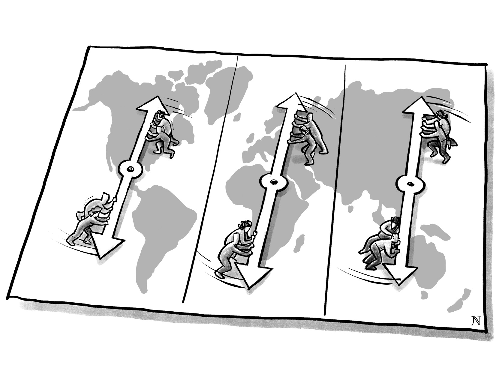
Naturally, that should be reflected in America’s security approach to the world.
From ANM:
In its own strategically intuitive way, the Pentagon has mentally prepared itself for the world of tomorrow. Consider a global map of US Combatant Commands and you quickly notice that the dominant lines run north-south, using oceans (Pacific, Atlantic, Indian) to divide the world into three vertical slices: the Western Hemisphere (Northern Command on top, Southern Command below), Asia (Indo-Pacific Command), and the busy Center slice comprising European Command on top, Central Command in the middle, and Africa Command below.
The US Navy has long ruled the open oceans as the world’s preeminent “blue water” fleet, meaning we possess the only navy that can swiftly mass forces anywhere in the world and conduct large-scale operations for long periods. In today’s strategic landscape, the notion of superpower navies contending for “sea control” is limited to individual regions, such as China-v-America in the Western Pacific or China-v-India in the Indian Ocean.
As a result, when we view the American military’s regional “areas of responsibility” (AORs), we find in each instance that the most troubled seams are found within those vertical slices—not between them. For example, America’s immigration crisis is currently fueled by the climate-ravaged Northern Triangle states found along our Northern/Southern Commands’ seam. In the Center, we locate (a) Russia versus EU/NATO (European Command); (b) Central Command working the Middle East terrorism/Iran beat to limit spillover into the European and African AORs; and (c) Europe’s Mediterranean climate-fueled migrant crisis pitting it against both North Africa (Africa Command) and the Persian Gulf (Central Command). Finally, in Asia (Indo-Pacific Command), we find China taking on all comers—but particularly India—within what could be called Indo-China Command because of that dyad’s signature rivalry.
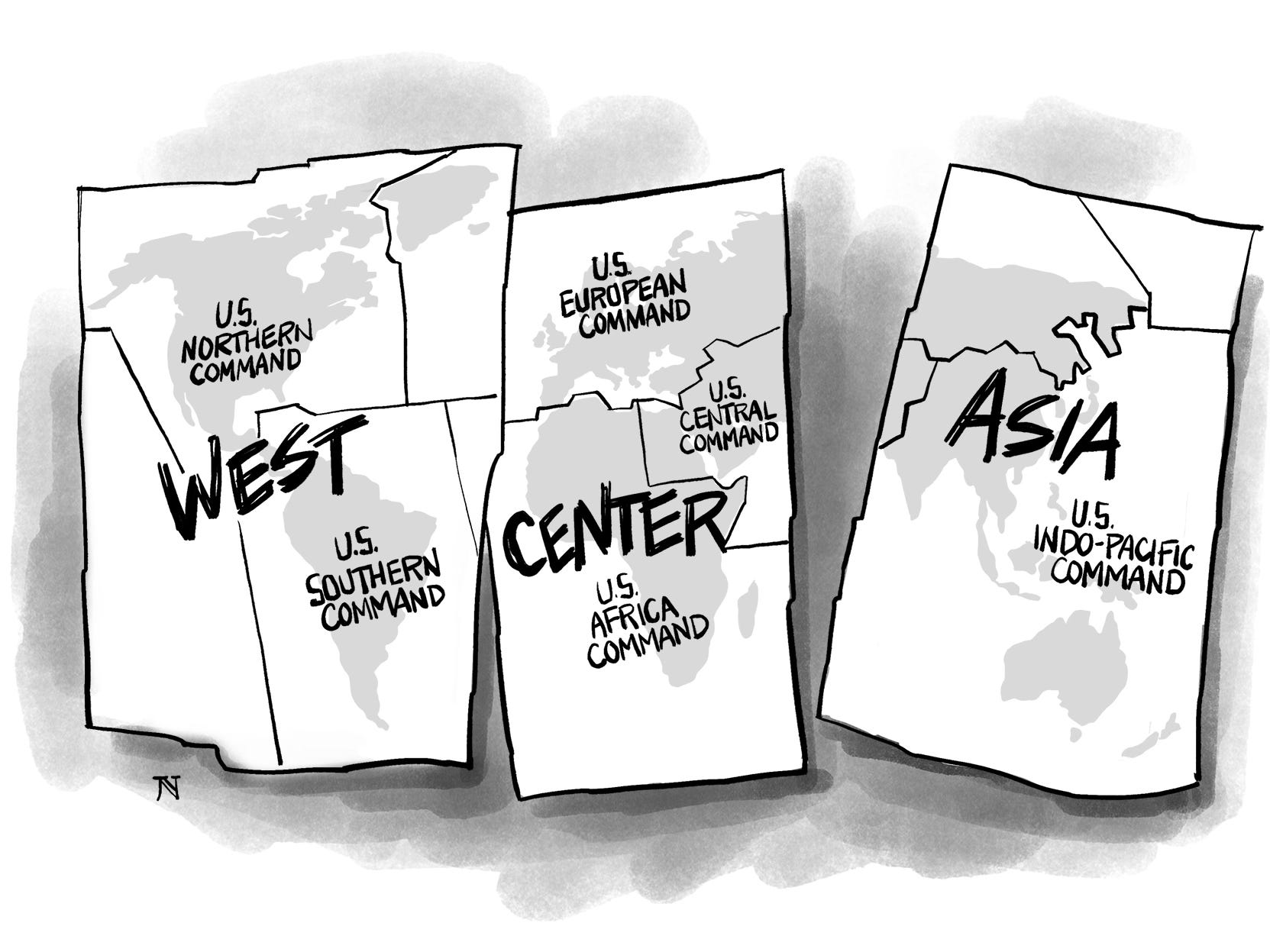
So, this is the natural geographic breakdown that ensues (and which is suggested above in the graphic): We should be looking at three “vertically-integrated” regional commands, or one in the West, one in the Center, and stick with the one we already consolidated in Asia.
Guess what? CSIS came to the same conclusion.
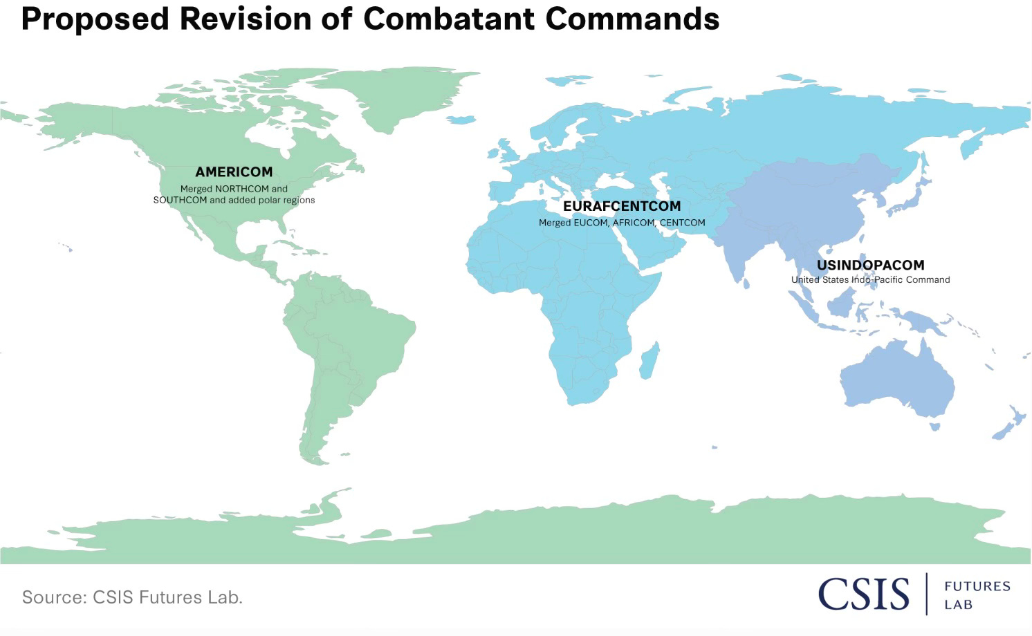
Besides combining SPACECOM and CYBERCOM and STRATCOM to reduce those numbers, the Center’s report argues for — what I would describe as — a “verticalization” of the remaining geographic commands, namely:
Combine North and South Com (and the polar regions) into AMERICOM
Collapse EUCOM and CENTCOM and AFRICOM into EURAFCENTCOM (too much of a mouthful so I would just stick with Central Command — as in, my Center slice)
Leave INDOPACOM as it is.
Three vertical slices, three vertical geographic commands.
Great minds, folks … great minds.
But you heard it here first.


Do you see the new North/South-oriented commands downsizing assets as well? It seems like this would require a quasi-fifth star to manage something like EuroAfriCentral Command under current structuring.