


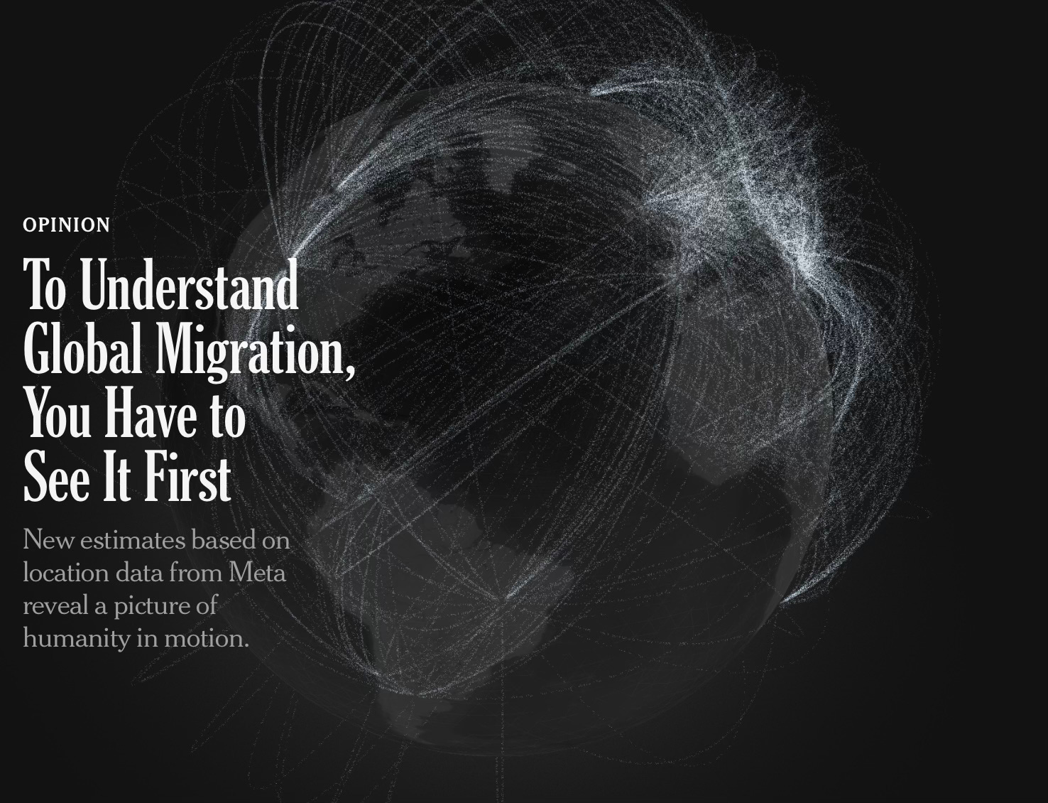
The world on the move
Fascinating NYT study confirms a lot of my analysis in "America's New Map"


Wonderfully informative piece in the NYT today, with h/t to Jeffrey Itell for sending on (he cheats by living in SE Asia so he’s always a solid 10-12 hours in the “future,” lucky bastard).
It’s a mega-cool study on migration and it confirms a lot of what I’ve been saying now for 10-15 years, so supremely validating.
The cool part of the study is that it uses proxy data, or better said — proxy big data.
Why I find that fascinating:

When I was doing my PhD research on Soviet bloc security and economic assistance to Third World “countries of socialist orientation,” there was simply no way to get the real data (this much weaponry, this much economic aid), because none of that saw the light of day. So, the question for me was: How to approximate the velocity and volume and direction (up/down, geographic vector) of this aid and cooperation?
I knew I could never get the real data, so I needed a proxy that would approximate. What data was out there? News reports of deputy minister or minister of department X going to that country and signing a deal indicating a relative level of commitment (some treaties or deals being bigger than others).
I found this East European studies researcher (American) who had developed a method of tracking these available data points and then projecting the various levels of cooperation that were happening.
Was it roughly accurate? Yes, and you could estimate velocity, volume, and vector of the resulting activities.
So … I learned Romanian and German well enough to read both and I scanned 20 years of those nations’ reporting media and journals to record every visit and every signed agreement and that allowed me to compare and contrast East Germany and Romania’s activities amidst the wider Warsaw Pact activities. It was just enough of a crazy lift (You did what? Man! That must have taken forever!) that Joe Nye and Adam Ulam and Houchang Chehabi (my diss committee) said, Yup, that works for a PhD diss!
As they say, all in all, you’re just another brick in the wall.
It took me working around the clock for 12 months to gather all the data, to include trips to the Library of Congress, but I got it done.
Why relate?
The NYT here did something similar: Virtually no chance to get data from every country in the world in a manner that allows for direct comparisons. They just don’t share or publish or record that data well enough or comprehensively enough for a truly global analysis to be done.
This great global migration is a staggeringly complex phenomenon with countless causes and implications. Yet perhaps no other issue is as pressing and as little understood by the average citizen and policymaker alike. Government records differ wildly from country to country, surges in illegal immigration are often only evident in retrospect and information isn’t collected at all in some corners of the world. As is the case with so many other things, we don’t even know what we don’t know.
So … the NYT found some proxy data they could work over:
In the maps below, Times Opinion can provide the clearest picture to date of how people move across the globe: a record of permanent migration to and from 181 countries based on a single, consistent source of information, for every month from the beginning of 2019 through the end of 2022. These estimates are drawn not from government records but from the location data of three billion anonymized Facebook users all over the world.
The analysis — the result of new research published on Wednesday from Meta, the University of Hong Kong and Harvard University — reveals migration’s true global sweep. And yes, it excludes business travelers and tourists: Only people who remain in their destination country for more than a year are counted as migrants here.
Brilliant! This is taking advantage of the big data out there, with the only limitation being those countries that ban Facebook (China, Iran, Cuba).
To me, this is like navigation system tracking all the users as they travel and then being able to estimate traffic flows. Simple enough once you have the big data, but you need to live in that world to access it.
So, just another example of how the Internet of Things will empower us as a species to understand ourselves and our world and how to evolve radically in response to things like demographic transitions, the rise of South-centric global majority middle class, and — of course — the amazing remapping of our planet by climate change.
So … let’s dig in for the key bits and cool maps:
First off, as the NYT notes, the US is exceptional:
The United States was the most popular destination for migrants in the world, according to the analysis. In 2022, a staggering 4.1 million people immigrated to the country. Meanwhile, 840,000 people chose to emigrate, making the nation the largest overall recipient of people in the world, with a net increase of over 3.2 million people.
No other country came close.
Since its founding, the United States has been a beacon for immigrants seeking refuge from persecution, war and poverty, and the country’s prosperity and growth have always been powered by the energy these newcomers bring. That promise of opportunity, as the data shows, places the United States far ahead of the rest of the world as a desired destination.

To me, that is immense national brand appeal turning into profound and non-stop economic strength. That’s not a popular interpretation right now, but it’s the truth.
America has maintained an artificial demographic dividend — non-stop — for decades by importing working-age migrants to fill out our desired “shape.”
That flow also keeps us young by aging us more slowly than any other great power — likewise a HUGE economic benefit.
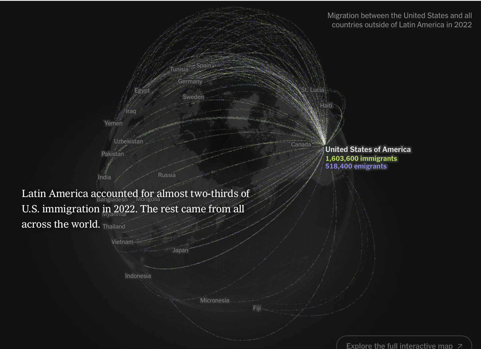
No surprise on the dominant vector: two-thirds of our record inbound flow comes from directly south, or Latin America and the Caribbean.
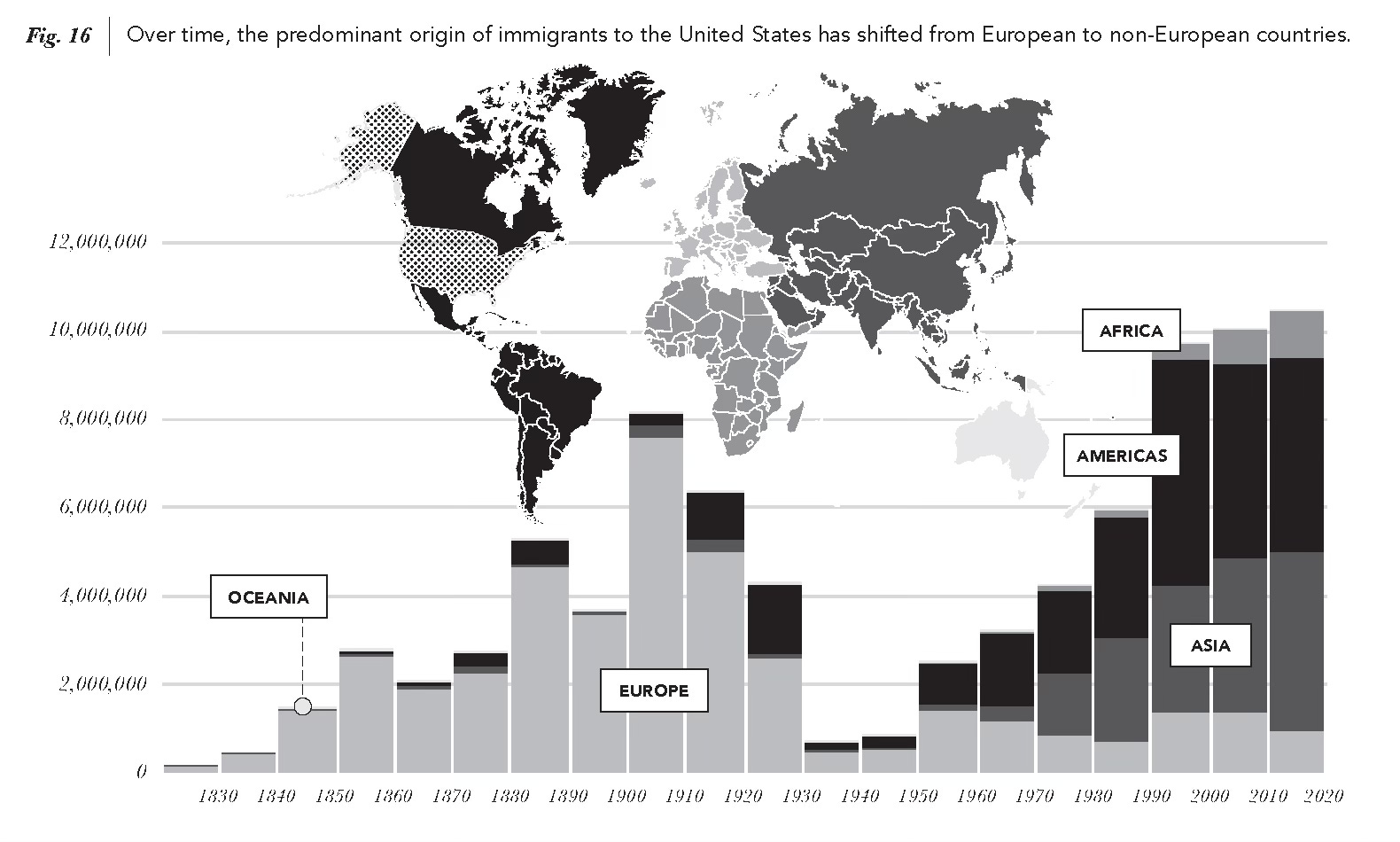
The other third comes from the Eastern Hemisphere.
Other interesting bits:
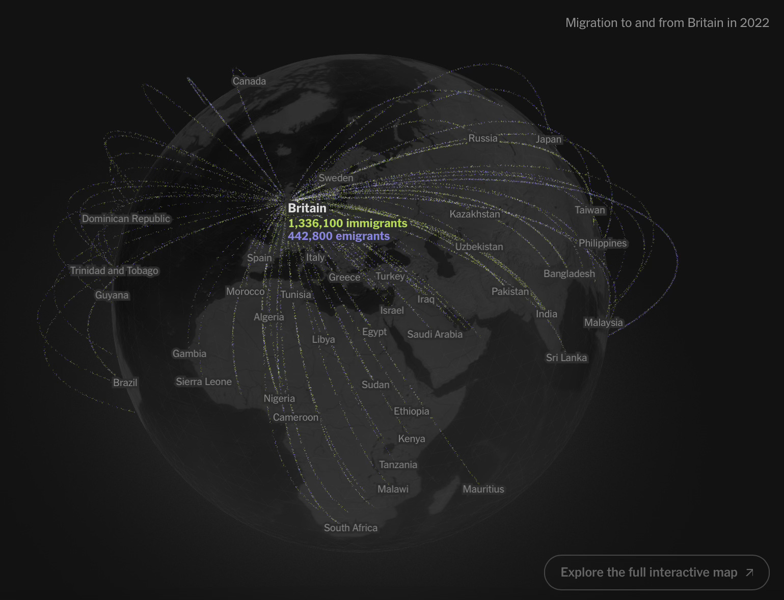
The classic post-colonial flow to the imperial seat. Stressful? Sure, but a huge gain for the UK, keeping them younger and more vibrant and more diversely prepared for global business.
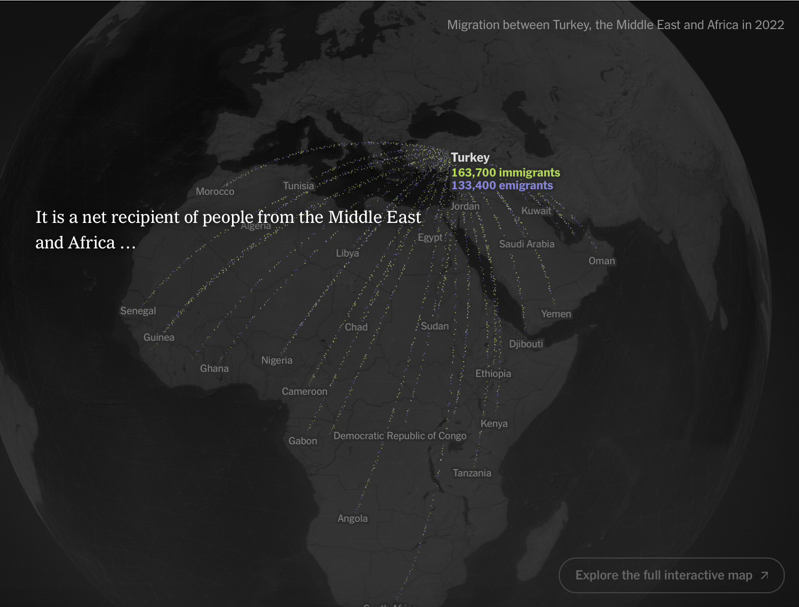
Turkey as the classic conduit, taking in from the Global South (or my Middle Earth) …
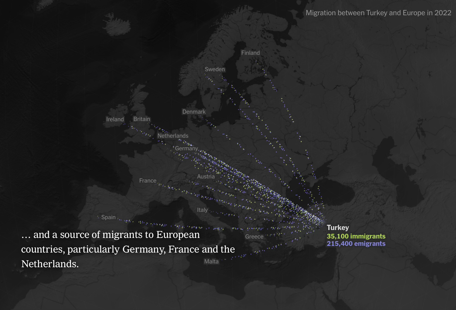
And ultimately processing through some portion to the EU.
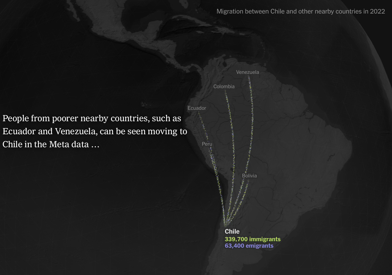
Per my argument on the “next country over” phenomenon: the poorest migrants tend to go to the best local option first …
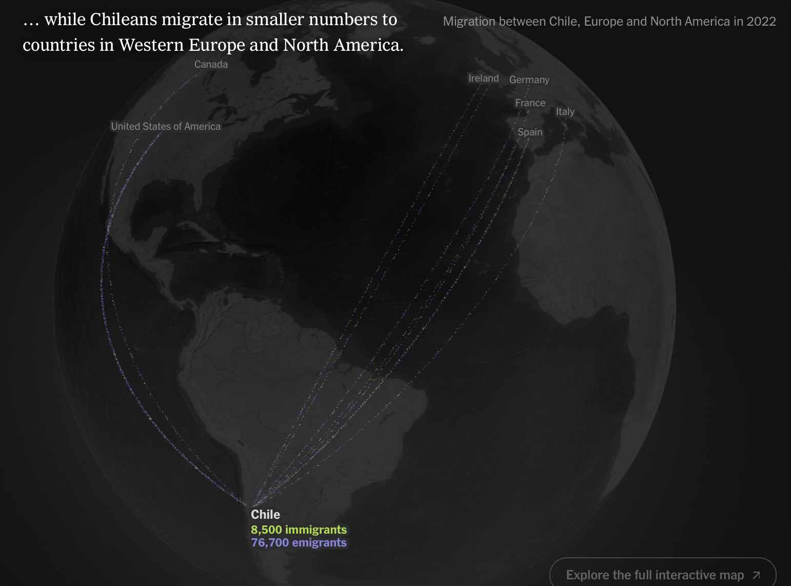
And, if that doesn’t work out, that interim step segues into eventual migration to the Global North.
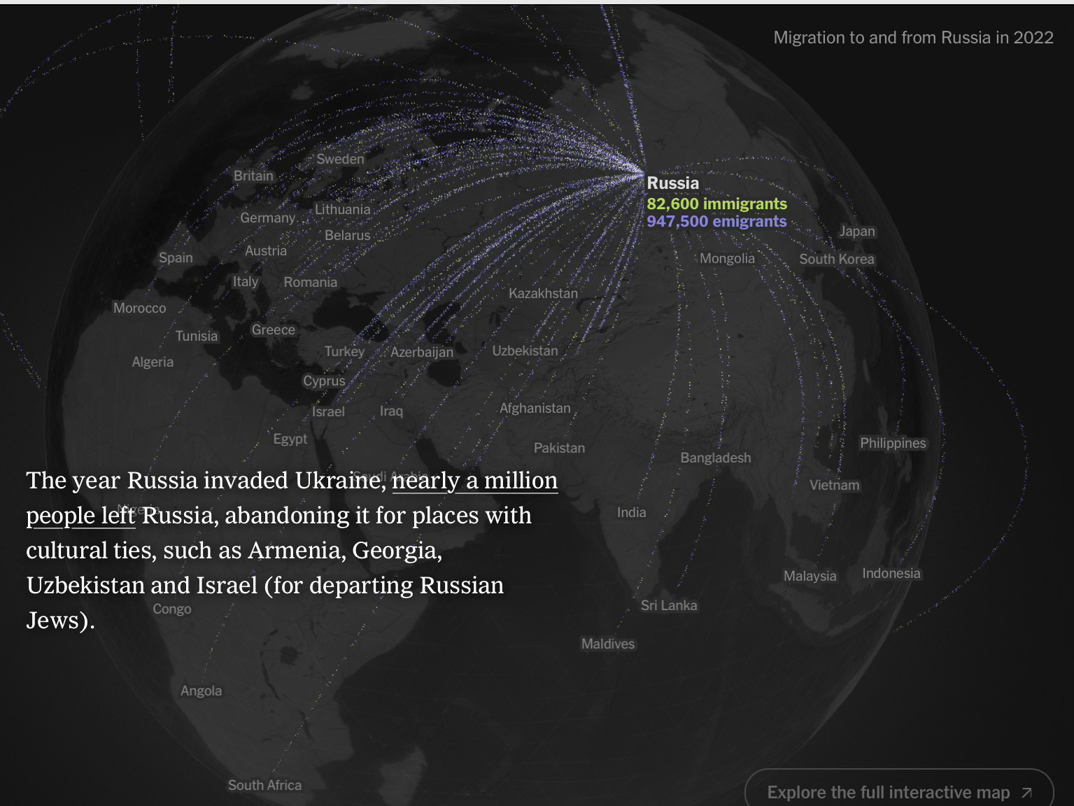
The power of war to put people on the move: Russia was net neutral on flows prior to invading Ukraine. That act triggered a big-time outbound flow.
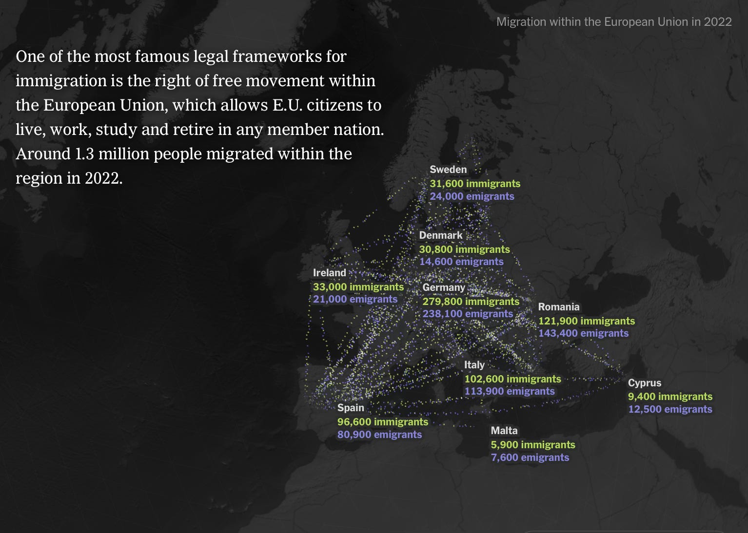
Here we see the EU as one of the two great freedom-of-movement regions in the North, the other being, of course, the US (movement and flows across our 50-member union) and — more generally — North America. Anybody across the Global South with serious ambition naturally wants to head to these two hubs.
But freedom-of-movement zones also exist across the Global South …
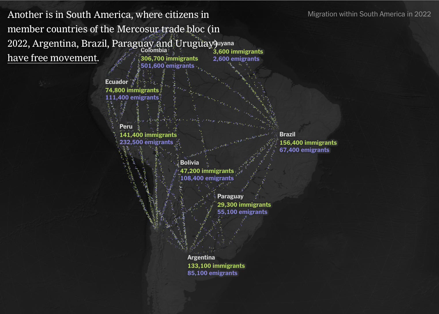
… like across South America (mostly a latitudinal flow or N←→S), and …
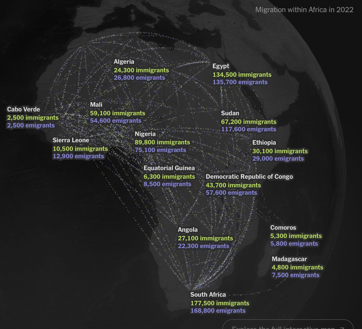
… across Africa, where one also notes the flow is primarily north or south.

And then, one final, very crucial lesson: border security is not — per se — the answer. The answer is having a system that is transparent and encourages flows in both directions:
Research suggests that tightening border controls can increase permanent immigration because it disrupts the natural circular pattern of human migration by locking people onto one side of the border.
Meaning, we’d get better control of immigration is we had an easier system to navigate, because then, migrants would come and go in response to economic signals — benefitting the US when we need them more and not burdening us with them when we don’t.
Trump 2.0’s border security crackdown is thus a bandaid. It deals with the friction but not the larger forces at work.
All in all, a fabulous report, well worth a complete read and a perusal of all those cool maps!


”
I'd be curious to see the internal migration flows of the US and Canada.
Would you consider an East/West migration from a warm coast to a cooler highland a climate (looking at Brazil/Columbia to the Andean countries) a "thematic" North/South climate migration pattern?